Our Methodology
This study used a Quantitative Descriptive Research Design to systematically collect and analyze data on Balakat trees (Ziziphus talanai) in Mabalacat City. This method allowed us to observe and describe the characteristics of the Balakat tree population without manipulating variables.
The Study Area
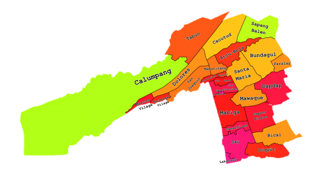
The research was conducted across 27 barangays of Mabalacat City, Pampanga, located at approximately 15°13′N, 120°34′E. Known for its rich soil and tropical monsoon climate, the area supports diverse plant life, including the culturally significant Balakat tree. Recent deforestation trends emphasize the need for conservation efforts and better biodiversity monitoring.
Sampling Techniques
Three sampling methods were used:
- Purposive Sampling for selecting participants involved in the system testing.
- Census Sampling for the complete inventory of all existing Balakat trees.
- Convenience Sampling for Alpha and Beta testing users.
Preservation and Identification
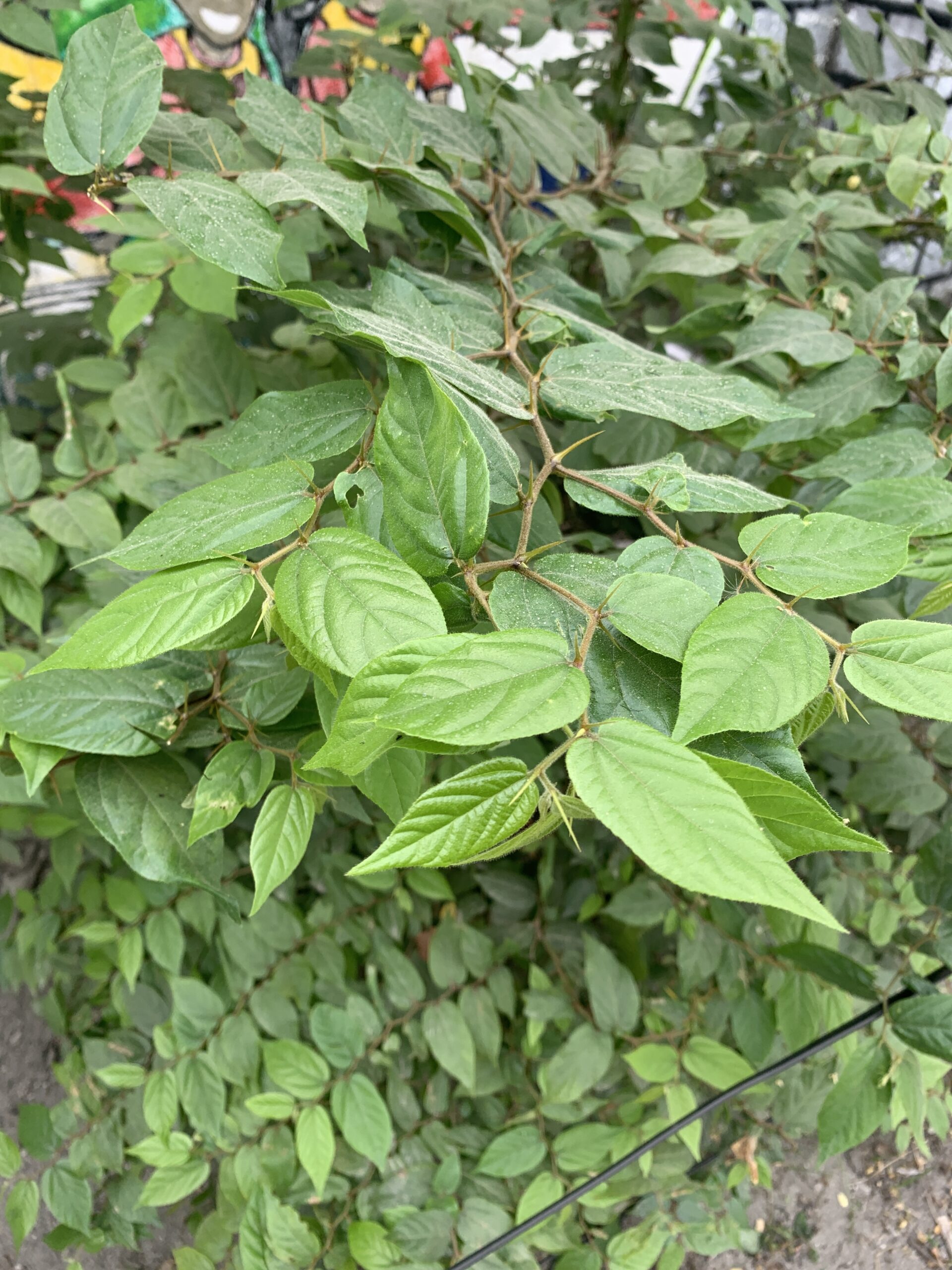
Collected leaves were preserved through pressing and drying, following standard herbarium practices. Identification was done using online databases and comparison with previous studies. For scientific verification, specimens were submitted to the Jose Vera Santos Memorial Herbarium at UP Diliman, labeled with full collection details.


Mapping the Coordinates of the Balakat Trees
To map the geographical coordinates of the Balakat trees within Mabalacat City, we used the GPS Map Camera and DA Geo Camera mobile application. This user-friendly app was selected for its portability, compatibility with both Android and iOS platforms, and its ability to record GPS coordinates directly into photos. During our fieldwork, each Balakat tree we encountered was photographed using the app, which automatically captured the latitude, longitude, date, and time of the photo. These geo-tagged images were then stored in our phone gallery for documentation and analysis.
To verify the accuracy of the recorded coordinates, we cross-checked the data using Google Maps. We manually inputted the GPS coordinates into the app to ensure that the marked locations accurately represented the actual positions of the trees. In cases where discrepancies were noted, we considered factors such as signal interference, environmental obstructions, or other field-related limitations. This validation process helped us maintain the reliability of our spatial data.
Formula Where
⦁ Dp – is the population density
⦁ N – is the total number of Balakat trees recorded
⦁ A – is the area (in square meters or square kilometers)
We counted the number of Balakat trees present within each identified area from our GPS mapping, then calculated the density by dividing that number by the corresponding land area. This provided insight into how densely Balakat trees are distributed across different zones of the city.
Formula Where
⦁ RF – is the relative frequency
⦁ f – is the number of Balakat trees in a specific area
⦁ n – is the total number of trees recorded across all areas
This approach allowed us to understand the distribution pattern of the species by identifying which barangays or locations had higher or lower concentrations of Balakat trees.
Morphometric Data and Carbon Sequestration Measurement of the Balakat Trees in Mabalacat City
Carbon Sequestration Calculation
Once we had both diameter (D) and height (H), we followed a step-by-step method based on formulas from Fransen (2024) to estimate the carbon sequestration potential of each tree.
⦁ Above-Ground Biomass (AGB):
AGB = 0.25 x D2 x H
⦁ Below-Ground Biomass (BGB):
BGB = 0.2 x AGB
⦁ Total Biomass (TB):
Total Biomass (TB) = AGB + BGB = AGB + 0.2 x AGB = 1.2 × AGB.
⦁ Total Dry Weight (TDW):
Total Dry Weight (TDW) = TB × 0.725
⦁ Total Carbon (TC):
Total Carbon (TC) = TDW × 0.5.
⦁ Carbon Dioxide Sequestration (CO₂ weight):
CO2 weight = TC × 3.67.
By following these computations, we were able to quantify the amount of carbon dioxide that each Balakat tree can sequester, contributing to an understanding of their role in carbon capture and environmental sustainability.
Stem Form


Tree Health
Your Attractive HeThe overall health of the tree was evaluated based on the crown’s condition, looking specifically for signs of:
⦁ Discoloration
⦁ Physical damage
⦁ Pest infestations
⦁ Diseasesading
